A Month in Michigan (Part 2): Way Up North
July-Aug. 2022

Tahquamenon Falls
It’s difficult to reserve a site at Michigan’s state parks for the summer, because everything gets booked up as soon as sites become available. We ended up staying at Onaway State Park in the northern tip of the “mitten” because I couldn’t nab a spot at one of the more popular parks. So, our out-of-the-way location meant we had to drive farther to get to the places we wanted to see. There wasn’t a lot to do at this park, either. The closest place to see was Ocqueoc Falls State Forest, about 15 minutes away. This was a tiny place, and the falls were small. From there, we drove another half hour to the Old and New Presque Isle Lighthouses on Lake Huron.
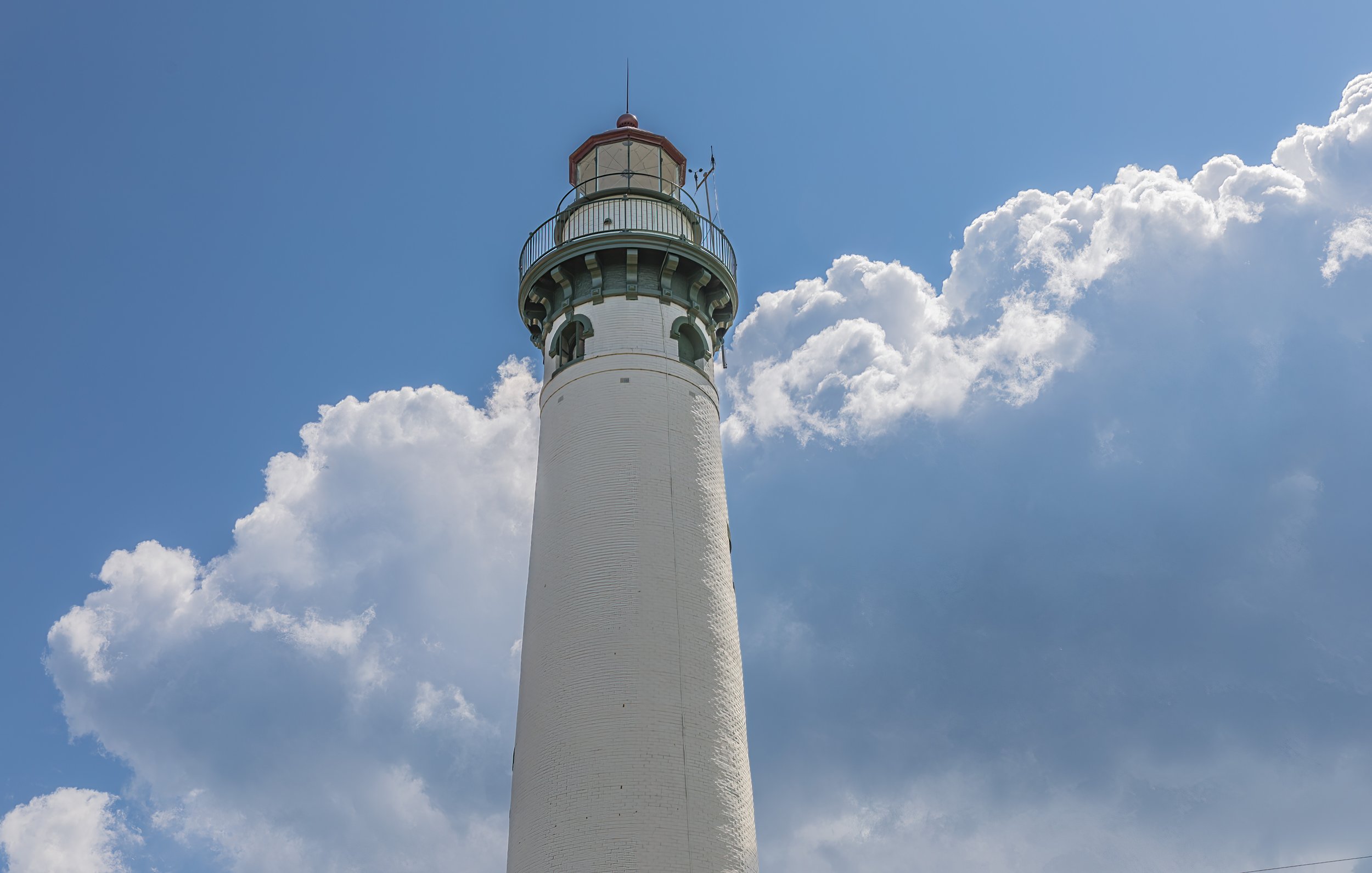
New Presque Isle Lighthouse

Those clouds had poured rain on us for a few minutes just as we parked the car, but then they moved on, and from the top of the lighthouse, we could see the rain still coming down farther away. We could also see freighters on Lake Huron.

View looking in the opposite direction. Lake Huron was the fourth Great Lake we’d seen since June.
Old Presque Isle Lighthouse was just down the road. It was a lot shorter.

We picked a day when the weather was good to go to Mackinac Island. I’m sure it’s busy there all the time, but the best weather day for us was on a Saturday, so the crowds were thick! Our ferry took a slight detour under the Mackinac Bridge, so we could see it up close. The Mighty Mac is the fifth-longest suspension bridge in the world. The towers rise 552’ above the water, and the roadway at the middle of the center span is 200’ above the water. There’s an amazing view from the bridge, but I wouldn’t want to be on it on a very windy day!

The first thing we did after the ferry docked was to walk up the hill past the fort towards Arch Rock. We could have rented bikes, but I am not steady on a bike anymore. We walked on a quiet, shady trail to the arch. It was already getting busy at 10:00, so we were glad we went there first.

The tiny dots on the water are kayaks.
Then we walked to the Grand Hotel. We paid $10 each to be allowed to walk around the hotel on a self-guided tour to see how the top one-half of one percent take a vacation. A double room there costs $350-400 per person/per night! The hotel bills itself as having “The World’s Longest Front Porch”.


View from the front porch of the Grand Hotel


Grand Hall in Lobby Level

One side of the Parlor, where afternoon tea is served

Main Dining Room—Patrons are required to dress up for dinner: men in coat and tie, women in a dress or dress pants.

View from the fifth-floor cupola bar


Besides biking or walking, the only other way to get around on the island is via horse and carriage. We had to watch where we stepped!

The island is cute, although the main street was very crowded and the food was pricey. I’d wanted to come here for a long time, and we finally made it!

One last thing we did in the northern tip of the mitten was drive the Tunnel of Trees, a narrow road along Lake Michigan where the trees’ branches reach over the road. It is a popular sight in the fall when the leaves change color.
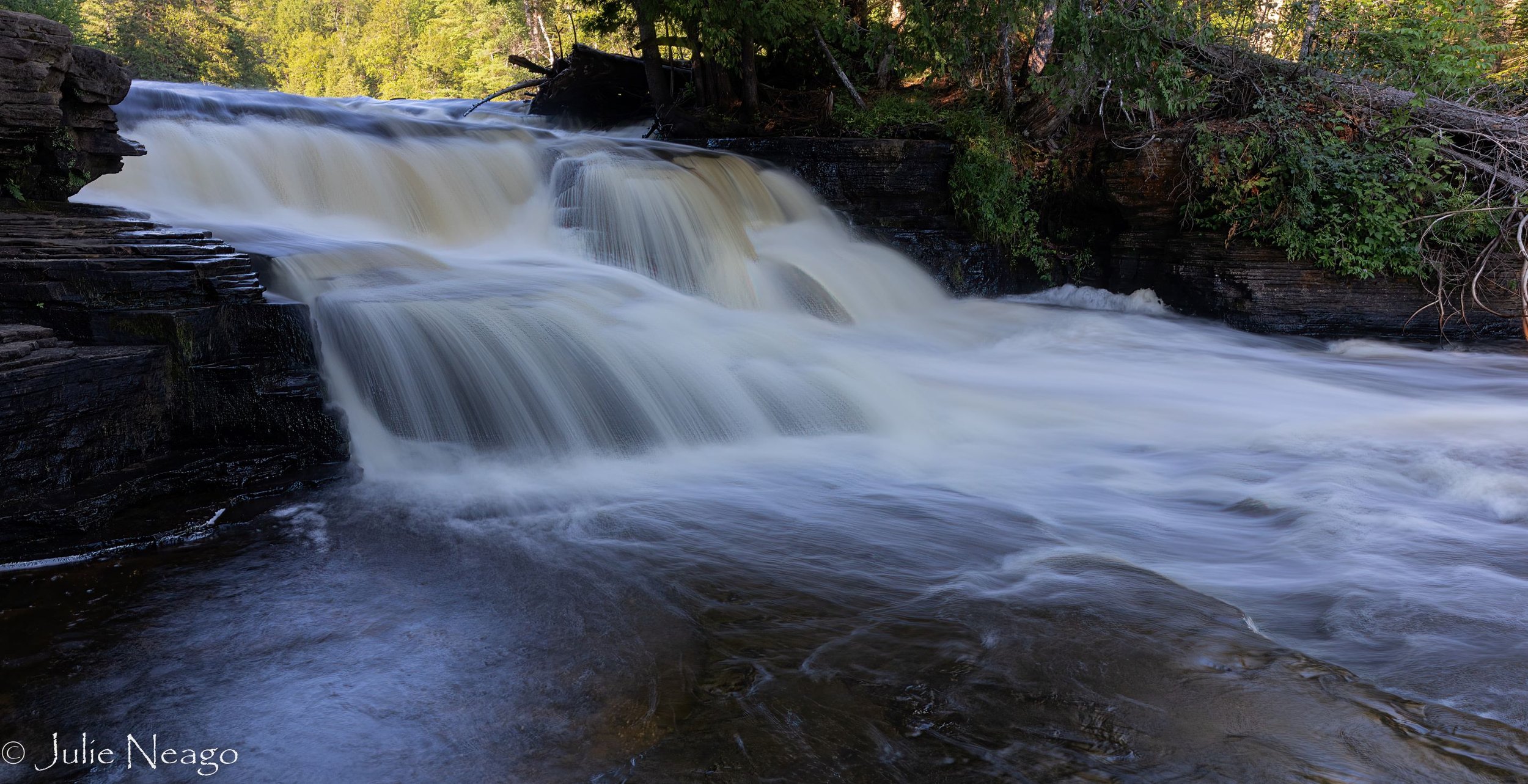
Then, we crossed the Mackinac Bridge to spend two weeks in Michigan’s Upper Peninsula. It felt more remote because it’s so far north and seemed to be mostly forest. Residents of the U.P. call themselves Yoopers, and they are proud of it, because it takes toughness to live here, where winters are long, cold, and snowy. We saw snowmobile trail crossings everywhere. The first place we camped at was Tahquamenon Falls State Park (rhymes with phenomenon.) As soon as we had our rig parked, we headed to the Upper Falls. The brown streaks in the water are caused by tannins in the plants that the water passes through.

A sunny mid-afternoon was not the best time of day for photos, as part of the falls were in bright sun, and part were in shade. Plus it was really crowded at the overlook. We had to climb down 94 steps for this close-up view, which meant we had to climb back UP.

We came back at about 7:30 in the morning for better light conditions, and no crowds. We were the only ones there for half an hour!
On another early morning, we went to the Lower Falls, which are a series of smaller falls where the river is wider.


The Great Lakes Shipwreck Museum was not far from the state park. It was located on Whitefish Point, the entrance to Whitefish Bay in Lake Superior, and is near where hundreds of shipwrecks have happened, including the famous wreck of the Edmund Fitzgerald. The museum was interesting, although crowded.


Crisp Point Lighthouse is not far from the museum as the crow flies, but it’s on miles of remote dirt road, so it warranted a separate trip.

Here’s one section of the lovely dirt road that led to Crisp Point Lighthouse!

This lighthouse was almost lost to the elements, but has been rescued.

Lake Superior rocks have many patterns and colors.

View of Lake Superior from the top of the lighthouse. There is a little sailboat on the horizon. The sun was shining through the clouds when we got there, but that changed quickly.

Fog rolled in fast! We were busy looking at all the colors of the rocks, when we looked up to find that we couldn’t see the sailboat anymore, even though it had moved closer to land.
One day we drove about an hour east to Sault Ste. Marie to see the Soo Locks. On the way there, we took the Whitefish Bay Scenic Byway along Lake Superior to a little out-of-the-way spot a friend recommended at an overlook on Ojibwe land called Mission Hill Cemetery.

The lake is called Spectacle Lake because it’s shaped like a pair of glasses. The thin ribbon of blue beyond that lake is where Lake Superior narrows as the water heads toward Sault Ste. Marie, and the distant land on the horizon is Canada.

We arrived at the Soo Locks just in time to see a 1000-foot long freighter finish its trip through the locks. The visitor center had information about the boats as they pass through. This particular freighter normally carries iron ore and is 105 feet wide—just 5 feet narrower than the lock itself.

The smaller lock closest to our viewpoint is used for smaller boats. The freighter is passing under the bridge that connects Sault Ste. Marie, Michigan with Sault Ste. Marie, Ontario, Canada.

The reason why the Locks were built. The locks close for 2 months every winter.

On this trip north, Michigan kept getting better, more interesting, and more beautiful. Next on the agenda: the western half of the U.P. and northern Wisconsin.