Southeast Utah National Parks and Monuments
(plus Corona Arch)
May 2021

Delicate Arch, Arches National Park
We revisited some of our favorite parks in southeast Utah: Arches, and Cedar Breaks, and saw the new-to-us parks: Hovenweep Nat’l Monument, Natural Bridges, and the Needles District of Canyonlands. We also visited Corona Arch, on BLM land outside of Moab.
Our first stop was in southeast Utah. We drove to the Needles district. (We had been to the Island in the Sky district a few years earlier.) On the way to the park entrance, we stopped at another “Newspaper Rock”. We could get up close to this. The petroglyphs were very clearly defined and easy to see.

The sky was overcast on the day we went to the Needles District, so I had some trouble taking pictures of the rock formations. I wasn’t smart enough to take multiple exposures and combine them, and I don’t have the filters I need for my zoom lens. So, the colors were dark and dull, and flat gray sky looks very boring in photos. We did hike a few easy trails in order to see the Needles formations. There are advantages to visiting in May as it isn’t too hot or crowded.


Wooden Shoe, Needles District
Another day, we drove to Natural Bridges Nat’l Monument. There are 3 bridges, with overlooks and trails down to them. We went to all 3 overlooks, but only hiked down to the smallest bridge, Owachomo. It’s 106 ft. high and 180 ft. across.

Contrails parallel the Owachomo bridge at Natural Bridges Nat’l Monument.
Along the road to Natural Bridges was part of Bears Ears National Monument, which is BLM land, not National Park Service. We drove down a dirt road to get to a hiking trail along Mule Canyon to some Native American ruins under a cliff called House on Fire, because the ceiling of the overhanging cliff look like flames above the ruins.

Another spot in southeast Utah way out in the middle of nowhere was Howenweep Nat’l Monument. This place has remains of buildings dating back to 1200 A.D. that were built by Puebloans. Some of the buildings are square or circular towers built on the edge of a cliff. Archaeologists are not sure what the functions were for the buildings, but some were probably for ceremonial purposes, for homes, or possibly even storage buildings. We followed a trail around the ravine that linked most of the ruins. I wish the visitor center had been open, so we could have learned more about what we were seeing. So many NPS visitor center exhibits are still closed due to Covid-19.


On the way to Moab, we stopped at Hole ‘n’ the Rock, because of course we have to stop at weird tourist attractions. We weren’t allowed to take pictures inside, but we did pay to take a tour. It was actually more interesting than we thought it would be. This one family spent years carving a 5000 sq. ft. house out of rock. They ran a restaurant inside the rock, as well. The tour guide told us how they dug out the rock and made it liveable. It was surprisingly well-lit by the windows along the front.

I made the mistake of scheduling our time in Moab right around Memorial Day weekend. It was already hot, and the crowds at Arches caused the park service to close the entrance for a few hours. We did manage to see Landscape Arch during the hot afternoon, when people with more sense were not at the park, and it was less crowded. Last time we were at Arches, it was September, and much, much cooler and less crowded. Landscape Arch was just as awesome as ever! Morning would have been the ideal time to take photos with the sunlight on the front of the arch, instead of overhead.

Next morning, before it got hot, we drove outside of Moab on BLM land to hike to Corona Arch. Evening would have been better for photography, as the morning sun was behind the arch. Also, I had read that the trail had some difficult spots to climb up using a cable to hold onto. Sure enough, one spot was particularly steep with toe holds carved out of the rock wall. Plus the wall was very close to the edge of a cliff. I stopped there and looked at the arch from a distance. Craig went on ahead to take photos from the sunlit back side of the arch, while I watched a number of people climb up those toeholds dragging their big dogs, who didn’t want to climb up, either! Corona Arch is huge! Worth the hike.
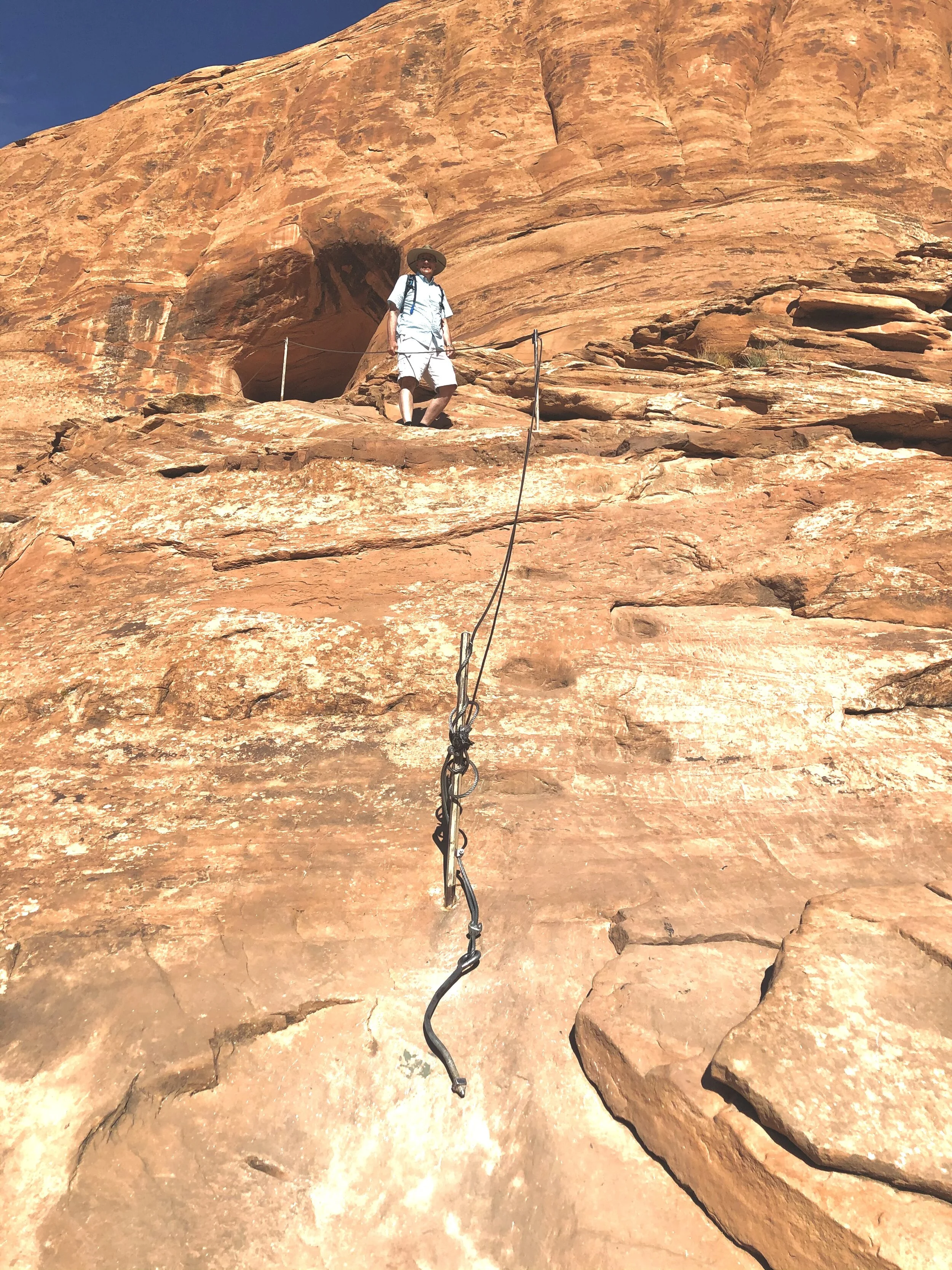
Tiny toe holds in the rock and a partly broken cable to boost people up the rock
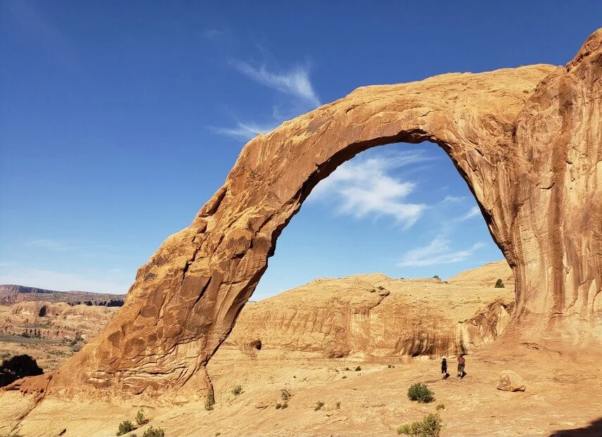
See the tiny people under huge Corona Arch?