Big Sur Coast, California
Driving (our car, not the RV!) down the Pacific Coast Highway
Oct. 2021
We parked the RV in a campground along Hwy 101 southeast of Monterey, and took a day trip in the car along the northern section of the Big Sur coastline, from Monterey to Pfeiffer Beach on Hwy 1. This stretch of highway is very windy, and not suitable for RV’s, although we did see a few RV’s brave the road.
We decided not to go to the Monterey Bay Aquarium, even though it’s top-rated, because it cost $50/person. We ended up seeing lots of marine mammals, anyway, just by driving down the coast! Our first stop was 17-mile drive at Pebble Beach. We paid about $10.75 total to drive the coastal road there. We enjoyed watching the many, many sea lions sitting on a big rock or swimming in the water below. We also saw a few sea otters floating on their backs and bobbing in the waves.


This bird didn’t seem afraid of us. It was busy looking for food along 17 Mile Drive.
Then, we did some window shopping in Carmel, and ate some California-style tacos. We didn’t spend too much time here, because we wanted to drive partway down Highway 1. Carmel is a cute town, but pricey.

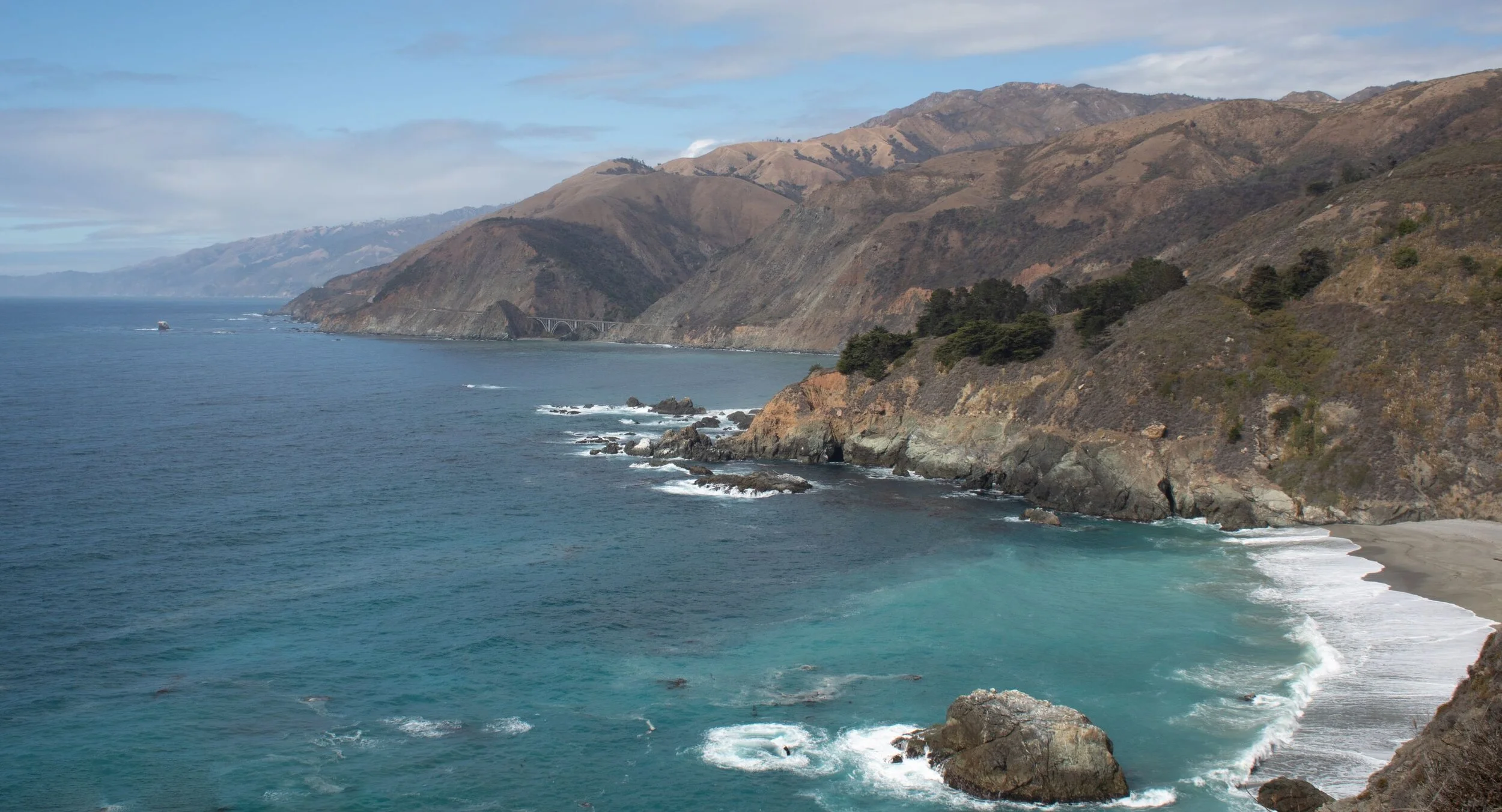
One of our first stops on the PCH was to look at the view from Bixby Bridge. Most of the trip down the Big Sur coastline looks like this: mountains and cliffs meeting the sea. Just beautiful, especially because there is very little development.

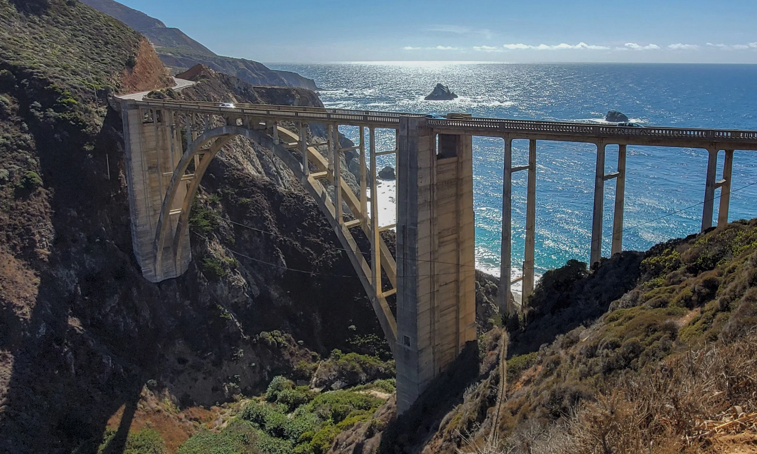

We stopped at an overlook for another view of Bixby Bridge. We thought the hills looked like a painting.
We drove as far as Pfeiffer Beach before we turned around for the long drive back to our campground. I had read in some blogs that Pfeiffer Beach was a must-stop, but we didn’t stay there long. The wind was strong and cold that mid-afternoon, and the position of the bright sun made it hard to get good pictures of the waves crashing through holes in the rocks. I’d read that the sand was purple, but it was only slightly purple in spots. Guess we just hit it at the wrong time. Plus, there was a very narrow dirt road to get down to it. Oh, well.
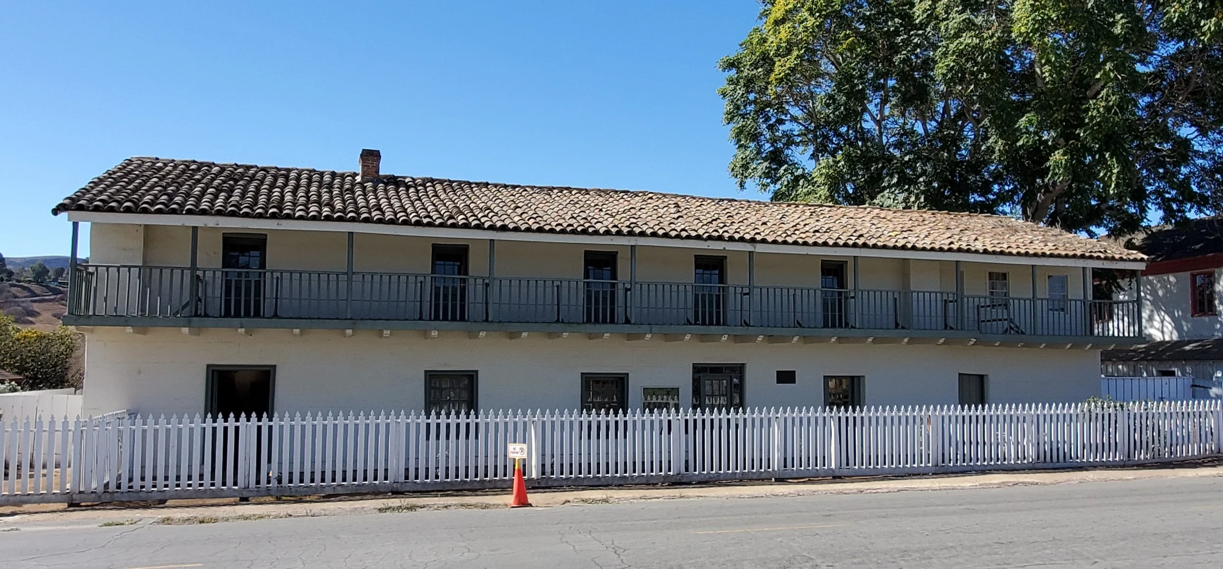
While we were staying in our campground south of Monterey, we decided to drive up to San Juan Bautista to see the mission there, which was an important setting featured in the Hitchcock film “Vertigo”. The mission has been continuously serving the community since 1797. It’s one of the Spanish missions along El Camino Real. Right next to the mission was a state historic park that cost only $3 per person. The buildings included a hotel, adobe home, another larger home, and stable. The large stable was built to shelter the stagecoaches that daily passed through, as well as the horses belonging to travelers staying at the hotel. San Juan Bautista was a busy way station in the mid-to-late 1800’s, for people traveling to work in the quicksilver mines or gold fields, or for those heading to San Francisco.

There is no tower as depicted in “Vertigo”. The tower was torn down due to rot.

Mission San Juan Bautista


This house was across from the mission. The second floor was used for public meetings and dances.

The parlor of the house.
This adobe house was built for General Jose Castro, and later bought by the Breen family, who were survivors of the infamous Donner Party.

The stable had quite a few old carriages and wagons, including this surrey, in which actress Kim Novak sat for a scene in “Vertigo”.
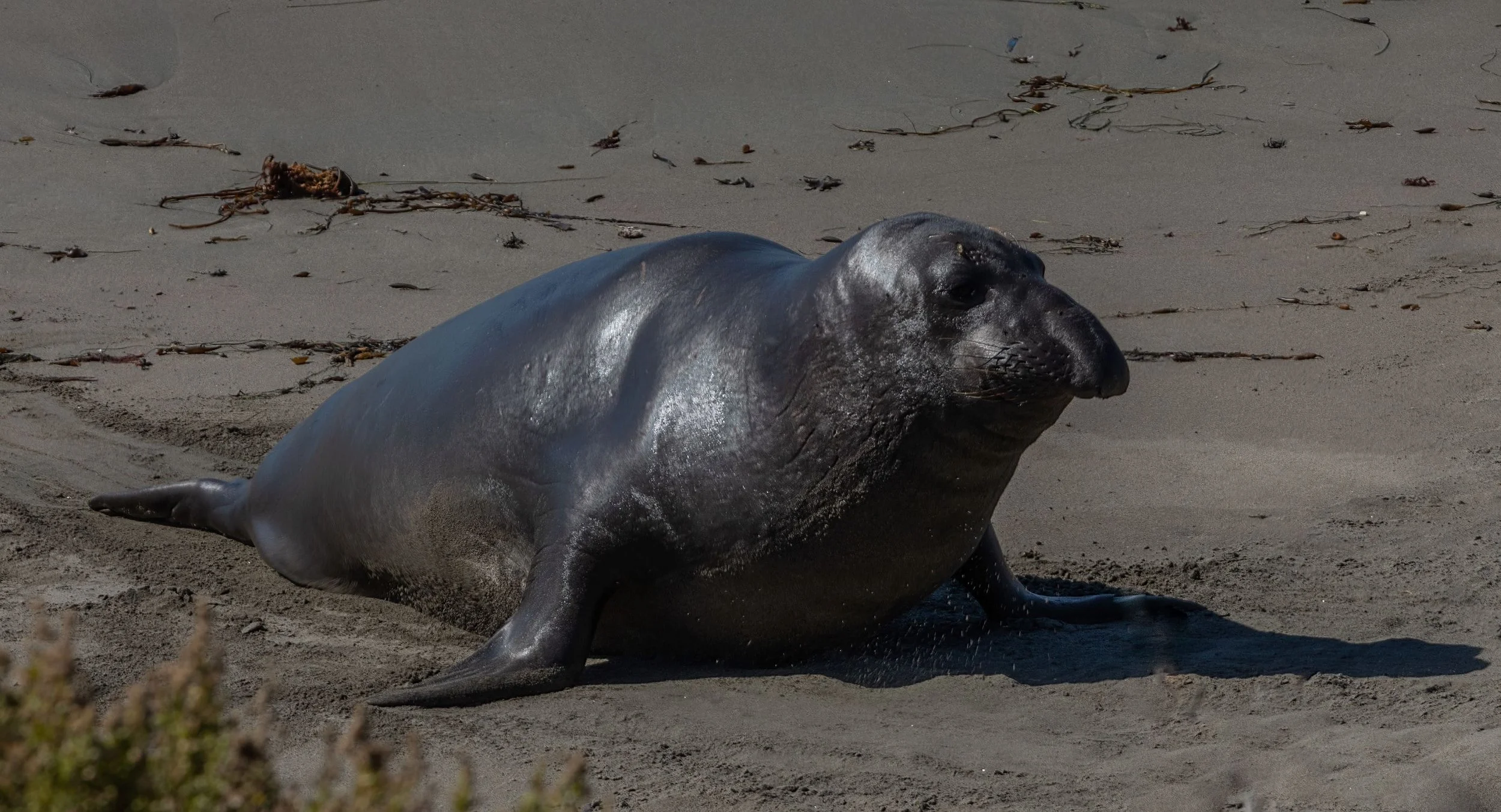
We traveled farther down Hwy 101 and stayed in a county park in San Luis Obispo, so we could drive up the southern part of the Big Sur coast. We had wanted to see Hearst Castle, but it has been closed for months, because the road that leads to the castle is undergoing extensive repairs. But, we did get to see Piedras Blancas Elephant Seal Rookery, near San Simeon. There were SO MANY elephant seals lying on the beach there. We could walk on a boardwalk overlooking the beach in order to see them. It was fun to watch them haul themselves out of the water and up the beach. Their bodies jiggled like jello!
That snout! No wonder they’re called elephant seals.
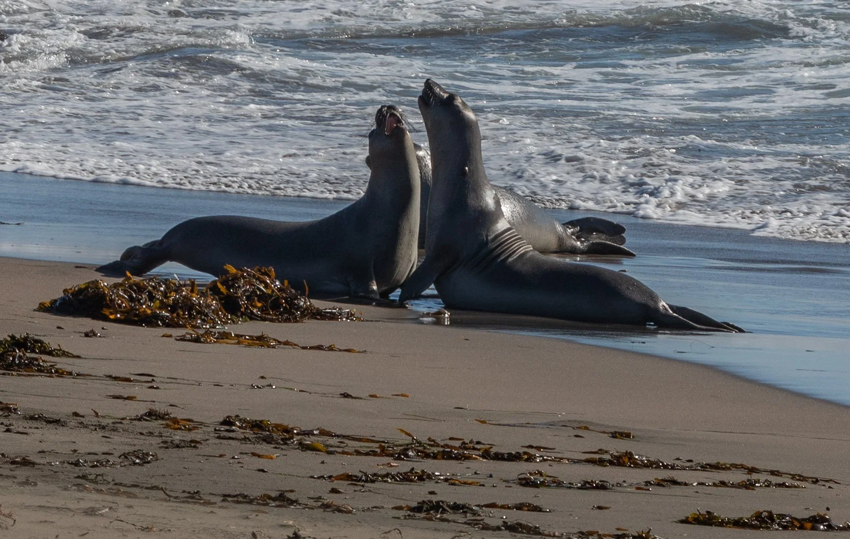
These two acted like they were arguing and kept it up for quite awhile.


This seal used its flipper to toss sand onto its back. Not sure why they do that. Behind it is the track it made in the sand as it hauled itself up the beach.
We drove up the PCH as far as McWay Falls in Julia Pfieffer Burns State Park. We walked a short trail to the overlook to the falls, which spill down onto the beach. No one is allowed to go onto that beach.

While we were staying in San Luis Obispo, we drove south one day to the cute town of Solvang, whose residents call it the “Danish capital of America” because of its heritage. The architecture makes it look like an old Danish town. There were several “windmills” and lots of bakeries serving Danish pastries. We went to Olsen’s Danish Village Bakery. Yummy! It was hard to choose which to get because there were so many different kinds of pastries.


Our last stop on the coast was to the little town of Morro Bay. There is a huge rock in the harbor called Morro Rock. We walked around that area, and watched a lot of surfers. We also stood on a dock on the Embarcadero to watch 18 sea otters lazily float around. Those otters were so cute!


We really enjoyed our time on the beautiful Pacific coast.